 https://winterwildlands.org/wp-content/uploads/2021/11/Photo-Credit-Zach-Snavely-square.jpg
1011
1210
Melinda Quick
https://winterwildlands.org/wp-content/uploads/2021/08/wwa_logo_wht2.png
Melinda Quick2021-11-17 15:46:532024-07-25 22:49:05Last Chance to Comment on the Shoshone National Forest Travel Plan
https://winterwildlands.org/wp-content/uploads/2021/11/Photo-Credit-Zach-Snavely-square.jpg
1011
1210
Melinda Quick
https://winterwildlands.org/wp-content/uploads/2021/08/wwa_logo_wht2.png
Melinda Quick2021-11-17 15:46:532024-07-25 22:49:05Last Chance to Comment on the Shoshone National Forest Travel PlanPublic Comment Period Closed on Shoshone National Forest Travel Plan!
The final 30-day public comment period ended on November 18, 2021. This was the last opportunity to enter comments into the public record and to establish standing for possible objection on specific topics when the “draft” final plan is released (eg. seasonal motorized closures on Beartooth Pass, new motorized designations on Togwotee Pass, motorized recreation within the High Lakes WSA, etc.). See below for more information.
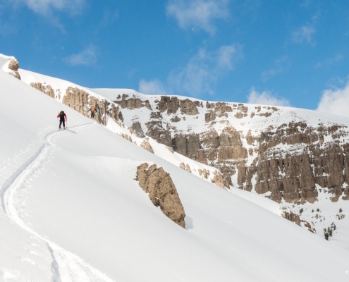
The Shoshone National Forest in Northwest Wyoming bills itself as a wild backcountry forest, and there are some amazing adventures to be had deep in the Wind River, Absaroka, and Beartooth mountains. These places are also diminishing habitat for wolverines, grizzlies and other species of sensitive wildlife. Our high-level concerns with the draft plan as proposed are as follows:
- For skiers/riders: One key thing that’s at stake in this travel plan, and where most skiers and splitboarders go, is the Shoshone’s relatively accessible world-class front-country terrain. Specifically on Togwotee Pass and the Beartooth Pass, where conflicts between motorized and human-powered recreation uses* have increased in recent years to the point where human-powered recreationists have begun to be displaced from these popular and accessible zones. These conflicts should be minimized through seasonal OSV use closures beginning April 30 (rather than June 15 as the EA suggests).
- The SNF fails to address increasing snowmobile use in the High Lakes Wilderness Study Area to comply with the 1984 Wyoming Wilderness Act.
- Designating the historic ski trail on Sublette Pass as an ungroomed snowmobile trail exacerbates rather than minimizes conflict between motorized and non-motorized uses.
- We very much support the proposed non-motorized winter recreation closure areas for cross-country skiing in the Falls/Deception and Pinnacles areas on the Wind River Ranger District (grooming operations would continue in these areas).
- Summer: The proposal adds significant new motorized trail miles (23) and adds four new OHV loops on the corner of the Forest with the most existing trail and enforcement concerns. The new motorized route proposals bisect Inventoried Roadless Areas, a Wild and Scenic eligible River, secure wildlife habitat and increase OHV traffic along the Fitzpatrick Wilderness. The plan states that the Shoshone has no additional enforcement or maintenance funding and the travel plan will not address unauthorized use or enforcement concerns.
- The SNF’s minimal environmental analysis and a rushed 30-day comment period disregards the importance of meaningful public comment, the complexity and consequence of travel planning, roads, and recreation, and the Shoshone’s unique role in the Greater Yellowstone Ecosystem and our National Forest system generally.
This was the FINAL comment period of a seven-year travel plan process. Our hope now is that the Forest will go back to the drawing board and complete a full Environmental Impact Statement addressing the many concerns we and others have with the alternatives and proposals considered.
* Nb. “Use conflict” vs. “user conflict: Travel planning is NOT about conflict between individual users, which would be a simple law enforcement issue, but rather the responsibility of land managers (the Shoshone National Forest) to address the underlying administrative conflict between different uses, ie. different expectations for specific recreational experiences and opportunities in specific geographical areas. eg. motorized recreation vs. quiet recreation.
Resources (Quick Links)
Details of the Environmental Assessment and all maps are located on the Shoshone National Forest project website.
Virtual Public Meeting recordings:
- Clarks Fork, Greybull, and Wapiti Ranger districts – November 2nd at 6:00 pm
- Wind River Ranger District – November 3rd at 6:00 pm
- Washakie Ranger District – November 4th at 6:00 pm
Make room for skiers on the Beartooth Pass!
(Please ask the Shoshone National Forest to establish April 30 seasonal closure dates for motorized use.)
Environmental Assessment Public Comment Deadline: November 18, 2021
The latest project documents can be found on the Forest Service project website. Or go straight to the latest Shoshone National Forest Environmental Assessment.
Our main concerns are as follows:
- Winter OSV Use Season should end April 30 (NOT June 15!) to protect wildlife and sensitive vegetation, and to reduce growing use conflict in popular spring/summer recreation areas such the Beartooth Plateau.
- In order to truly to minimize use conflict as well as impacts to wildlife and resources, OSV use designations must be made based not merely on suitability but on site-specific analysis.
- There should be no increase in motorized routes/loops in the new plan given the levels of illegal use and the fact that the current system is not being enforced or maintained adequately. Take care of what is already there!
https://winterwildlands.org/wp-content/uploads/2021/11/Photo-Credit-Zach-Snavely-square.jpg
1011
1210
Melinda Quick
https://winterwildlands.org/wp-content/uploads/2021/08/wwa_logo_wht2.png
Melinda Quick2021-11-17 15:46:532024-07-25 22:49:05Last Chance to Comment on the Shoshone National Forest Travel Plan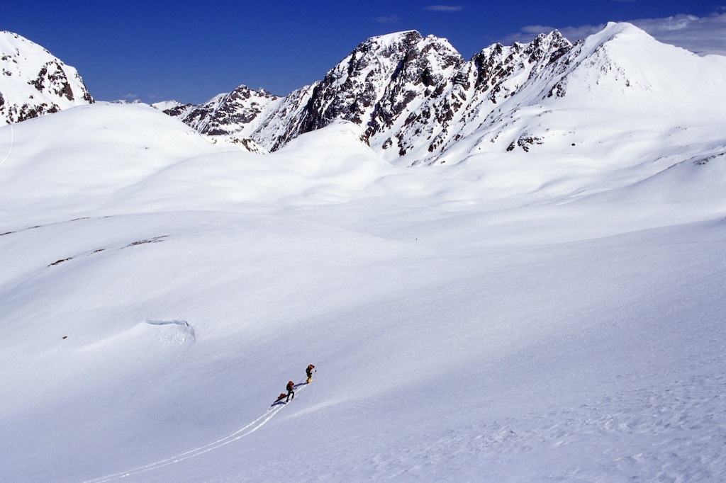 https://winterwildlands.org/wp-content/uploads/2015/06/SKBT_160.jpg
682
1024
Dpage
https://winterwildlands.org/wp-content/uploads/2021/08/wwa_logo_wht2.png
Dpage2021-11-02 13:47:302021-11-08 10:45:52Shoshone NF Holds Virtual Public Meetings Before Comment Deadline
https://winterwildlands.org/wp-content/uploads/2015/06/SKBT_160.jpg
682
1024
Dpage
https://winterwildlands.org/wp-content/uploads/2021/08/wwa_logo_wht2.png
Dpage2021-11-02 13:47:302021-11-08 10:45:52Shoshone NF Holds Virtual Public Meetings Before Comment Deadline https://winterwildlands.org/wp-content/uploads/2020/08/IMG_3221-scaled.jpg
1920
2560
Winter Wildlands
https://winterwildlands.org/wp-content/uploads/2021/08/wwa_logo_wht2.png
Winter Wildlands2020-08-07 19:10:302022-09-29 15:41:31Shoshone Winter Travel Planning Is Underway
https://winterwildlands.org/wp-content/uploads/2020/08/IMG_3221-scaled.jpg
1920
2560
Winter Wildlands
https://winterwildlands.org/wp-content/uploads/2021/08/wwa_logo_wht2.png
Winter Wildlands2020-08-07 19:10:302022-09-29 15:41:31Shoshone Winter Travel Planning Is UnderwayArchive: Preliminary Environmental Assessment (August, 2020)
Read Winter Wildlands Alliance and Togwotee Backcountry Alliance Preliminary EA Comments.
All of the earlier project documents can be found on the Forest Service project website. Click the “Analysis” tab to download the Preliminary Environmental Assessment (or download it here). The Preliminary Environmental Assessment includes 3 alternatives – the “no action” (status quo) and two “action” alternatives that are very similar. Each alternative covers summer and winter travel management, but we will only be focusing on the winter aspects of the EA.
Although there are a few things that we like in the Alternatives, overall, we are disappointed with this EA. At all earlier stages of the planning process the Forest Service stated that it would be drafting an Environmental Impact Statement (EIS), and we were surprised when they announced earlier this summer that they would be publishing an Environmental Assessment (EA) instead. While an EA can be appropriate for some travel management plans, the Shoshone plan is too complex for this less detailed type of analysis. There are many deficiencies in the EA (including a complete disregard for backcountry skiing!) and the only way the Shoshone is going to be able to remedy these deficiencies is for the forest to take a second look at all the comments they received in 2016 and 2017 and draft an EIS.
It’s important to weigh in on the Preliminary EA during this comment period so that the Shoshone understands what they need to fix. And, there are a few good things in the alternatives that are definitely worth supporting. Here’s the breakdown:
Needs Fixing
- Rather than follow the “closed unless designated open” paradigm that the OSV Rule requires, the Shoshone’s approach to winter travel planning is “open unless designated closed”. This is a fundamental flaw that leads to many problems, like designating a desert area for snowmobile use.
- Alternatives 1 and 2 do not set season dates for OSV use on the Shoshone National Forest. Alternative 2 sets an OSV Season with the following dates:
- The North Zone, which includes the Clarks Fork, Greybull, and Wapiti Ranger Districts, will allow OSV use November 1 to May 31.
- The South Zone, which includes the Wind River and Washakie Ranger Districts will allow OSV use from December 1 to May 31.
- Unfortunately, the South Zone dates do not align with the neighboring Bridger-Teton National Forest (December 1 – April 30), which will create confusion and inconsistent management on Togwotee Pass, and the North Zone dates do nothing to alleviate the use conflict and natural resource damage that occurs on the Beartooth Pass starting in mid-May (see video, above).
- Alternatives 1 and 2 both authorize OSV use within a substantial portion of the Line Creek Research Natural Area – an area on the Beartooth Plateau that is supposed to be closed to motor vehicle travel in order to protect its rare alpine tundra vegetation for scientific study.
- There is no mention of user education, setting OSV speed limits on certain shared-use trails, or other measures that could reduce use conflict in areas that are popular with both snowmobilers and skiers.
What We Support
- Alternatives 2 and 3 both protect the Deception Creek and Pinnacles cross-country ski trails on Togwotee Pass by not designating the area surrounding these trails for OSV use.
- Alternative 3 includes our recommendation for how to manage OSV use within the High Lakes Wilderness Study Area, striking a balance between protecting wilderness character in the Wilderness Study Area and the adjacent Absaroka-Beartooth Wilderness and providing high-quality opportunities for snowmobiling on the Beartooth Plateau.
Click on the links below to read the comments we’ve sent in to the Forest Service previously
- Winter Wildlands Alliance Pre-scoping Comments (2015)
- Winter Wildlands Alliance round 1 Scoping Comments (2016)
- Winter Wildlands Alliance round 2 Scoping Comments (2017)
Press
Wyofile.org 12/8/2017. Skis and Snowmobiles: National forest examines winter travel.

![]()