SNOWPACK PREDICTION CONTEST: MT SHASTA NORDIC CENTER 2019-20
 Can your classroom accurately predict the amount of snow that we will have on Mt Shasta this year? Send SnowSchool your prediction and you could win a prize for your entire classroom! The closest class wins the prize!! Winners will be announced in the spring.
To participate review the information below and then send your snow depth and snow/water equivalent prediction to SnowSchool by clicking this link.
Questions? Email- kmcclay@winterwildlands.org; justi@mtshastanordic.org
Specifically, SnowSchool wants to know your prediction for the maximum snow water equivalent measurement over the course of the winter at nearby Sand Flats Weather Station (on Mt Shasta). You’ll see below that we’ve provided a graph with historical snow data. So look at this years graph and all the other years and come up with a prediction of your own! One prediction (snow water equivalent) per class please (this should be one number in inches).
Example: Prediction for Ms. Smith’s Class- 50 inch snow water equivalent
Having trouble remembering the definition of snow water equivalent? Big name, simple concept. Imagine if you instantaneously melted all the snow sitting on the ground at the Pilot Peak weather station, well the depth of the melted water sitting on the ground would be the snow water equivalent. Its the same thing as snow water content, and this link provides a good explanation.
Once you make your prediction your class name will be added to this page below and you will be able to track and compare your prediction to the live snowpack graphs as it grows (or melts) each week of the winter!
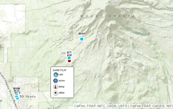
The Sand Flat weather station is located on Mt Shasta and measures snowpack data.
The above graph links are updated every hour from the Sand Flats weather station.
Click to view the interactive map below.
Contest predictions will be posted below. Click here to submit a prediction.
Want to learn more about weather stations and the connection between mountain snow and water?
HISTORICAL SNOWPACK DATA: Its important to keep track of snow, how much of it there is in the mountains because mountain snow is our source of water in California. If we have less snow than normal, we could have less water available for people to use. In making your prediction you will want to look at what happened in previous years (see graphs below), how much snow and snow/water equivalent we have on the ground right now (above graph), any data you collected during your SnowSchool field trip, and historical/forecasted weather. To help with your predictions we’ve compiled 20 years of snowpack data below-
Some Snow Water Equivalent data isn’t showing up on the live graph, but this data has been collected at Sand Flat consistently for decades. Here is the last 20 years of Snow Water Equivalent Data:
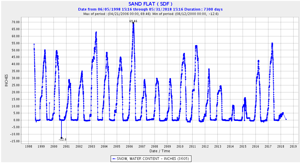
All data collected from the Sand Flat Weather Station. Click to view additional years.
Winter Wildlands Alliance is a national nonprofit organization promoting and
preserving winter wildlands and a quality human-powered snowsports
experience on public lands.

![]()