SNOWPACK PREDICTION CONTEST: GNFAC
Can your team (3-4 students) accurately predict the amount of snow that we will have in the mountains around Livingston Montana this year? How about the snow/water equivalent? Send SnowSchool your prediction, closest group/team wins the prize! Winners will be announced in the spring.
Send your snow depth and snow/water equivalent prediction to SnowSchool by clicking this link.
Questions? kmcclay@winterwildlands.org
Specifically, SnowSchool wants to know your predictions for the greatest snow depth measurement and the greatest snow/water equivalent measurement during the course of the entire winter at each of three SNOTEL stations around Livingston. These three stations each measure snow that will eventually melt and flow into the Yellowstone River.
EXAMPLE: Predictions for Team A (Casey, Erin, Jesse) –
Parker Peak SNOTEL Station: 55 inch snow depth, 16.5 inch snow/water equivalent
Porcupine SNOTEL Station: 40 inch snow depth, 10 inch snow/water equivalent
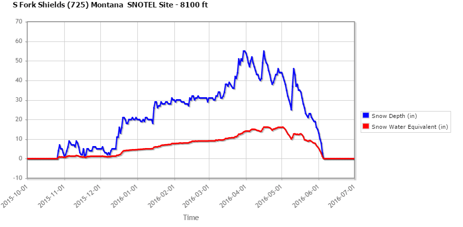
South Fork Shields SNOTEL Station: 50 inch snow depth, 14.1 inch snow/water equivalent
Once you make your predictions your groups name will be added to this page below and you will be able to track and compare your prediction to the live snowpack graph as it grows (or melts) each week of the winter.
The numbers above are updated every hour from the SNOTEL website. You can also view a graph of each station’s snowpack data as it grows/melts over the winter. Click to view:
Parker Peak SNOTEL Station graph
Porcupine SNOTEL Station graph
South Fork Shields SNOTEL Station graph
Click here to submit predictions. Contest predictions will be posted here below:
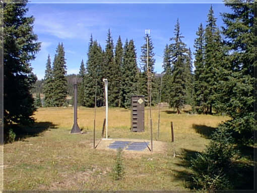
Picture of a typical SNOTEL station:
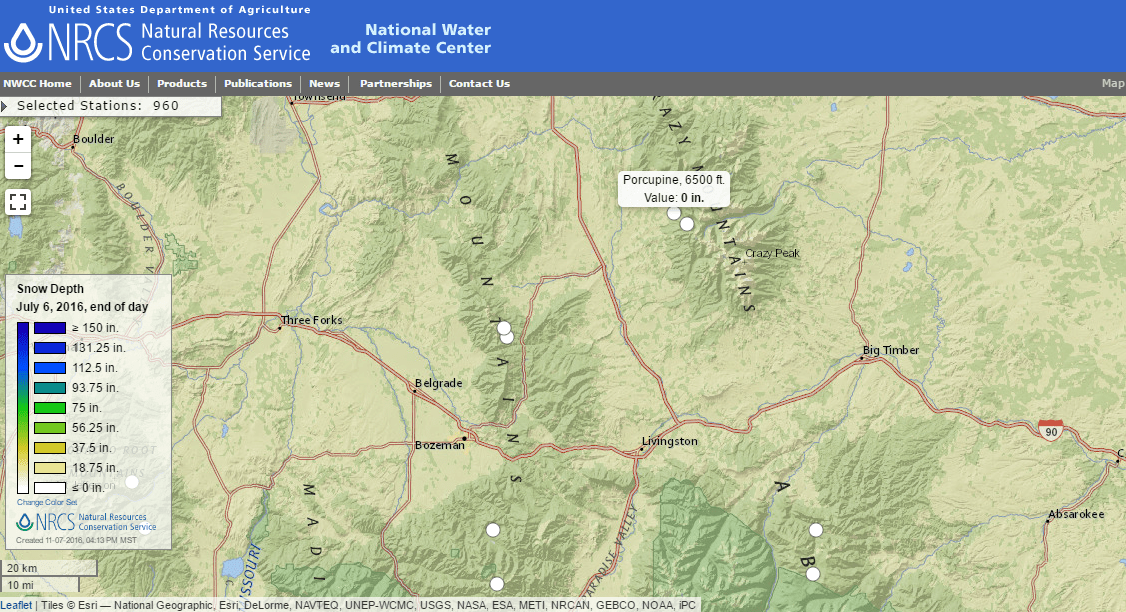
View the interactive map of SNOTEL stations in the mountains around Livingston:
Want to learn more about the connection between mountain snow and water?
HISTORICAL SNOWPACK DATA: Its important to keep track of snow, how much of it there is in the mountains because mountain snow is our source of water in Montana. If we have less snow than normal, we could have less water available for people to use. In making your prediction you will want to look at what happened in previous years (see graphs below), how much snow and snow/water equivalent we have on the ground right now (above graph), any data you collected during your SnowSchool field trip, and historical/forecasted weather. To help with your predictions we’ve compiled snowpack data from each of the three SNOTEL stations-
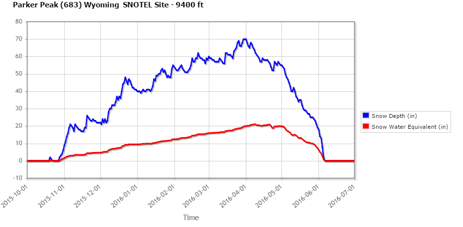
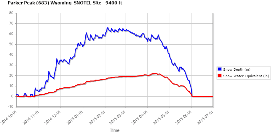
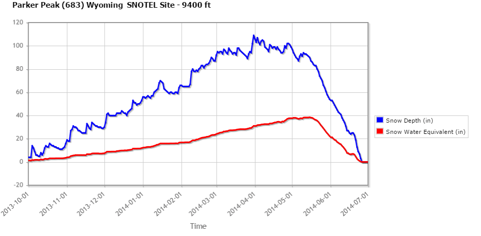
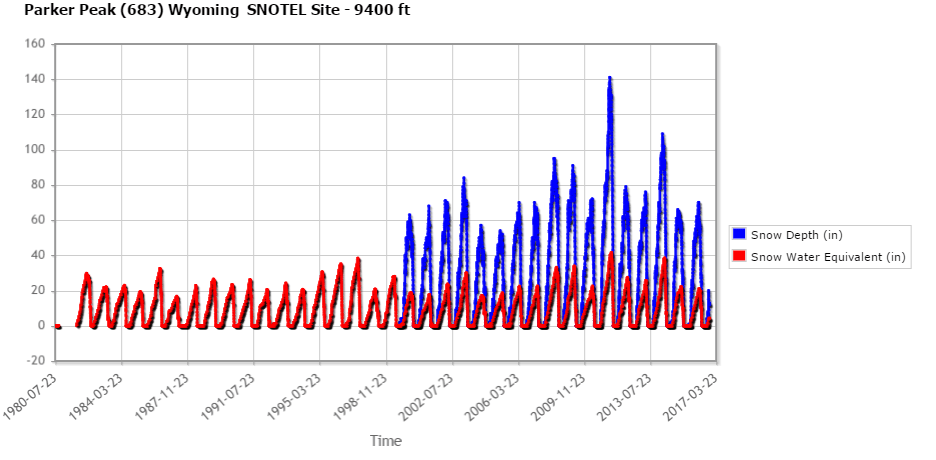
PARKER PEAK SNOTEL STATION HISTORICAL DATA
Winter 2015-16
Winter 2014-15
Winter 2013-14
All available data since 1980
Click to view additional data from Parker Peak SNOTEL Station
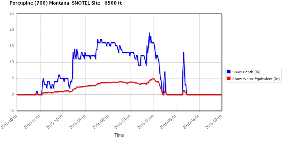
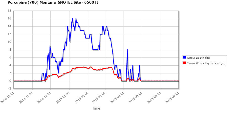
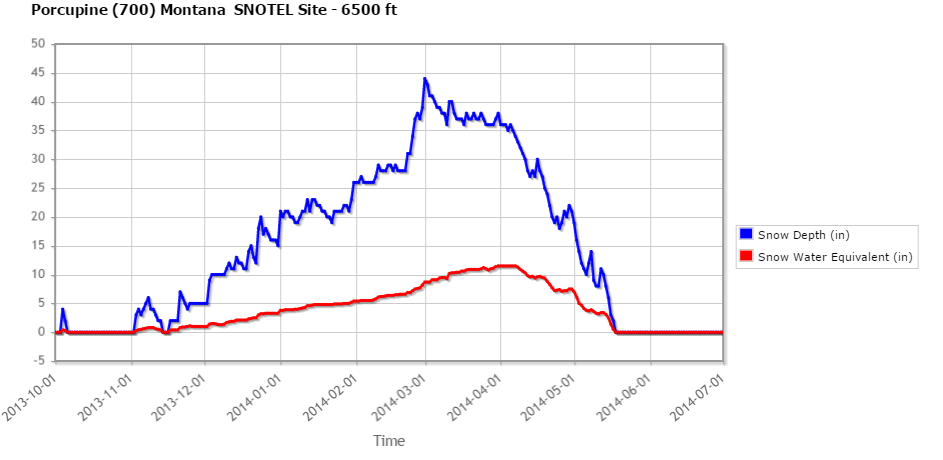
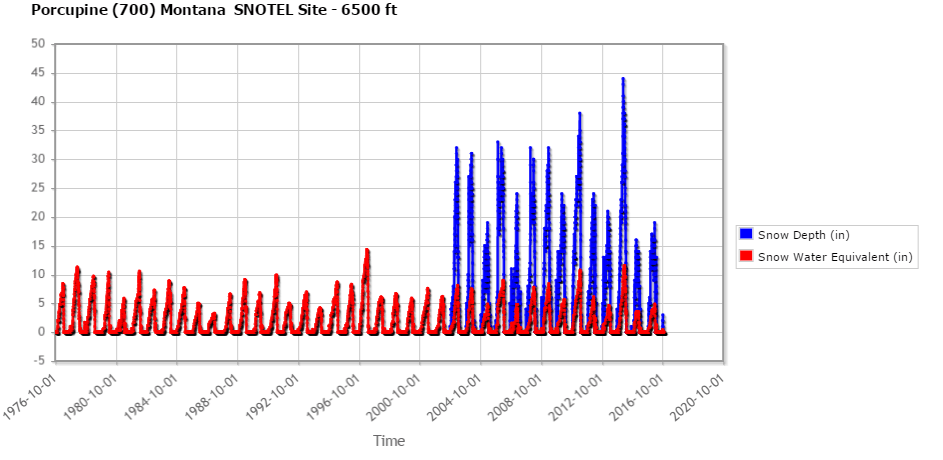
PORCUPINE SNOTEL STATION HISTORICAL DATA
Winter 2015-16
Winter 2014-15
Winter 2013-14
All available data since 1976
Click here to view additional data from Porcupine SNOTEL Station
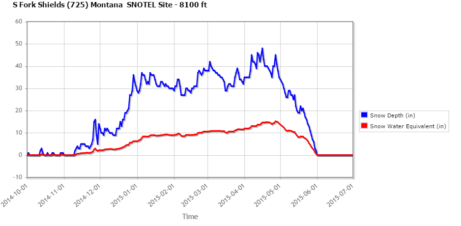
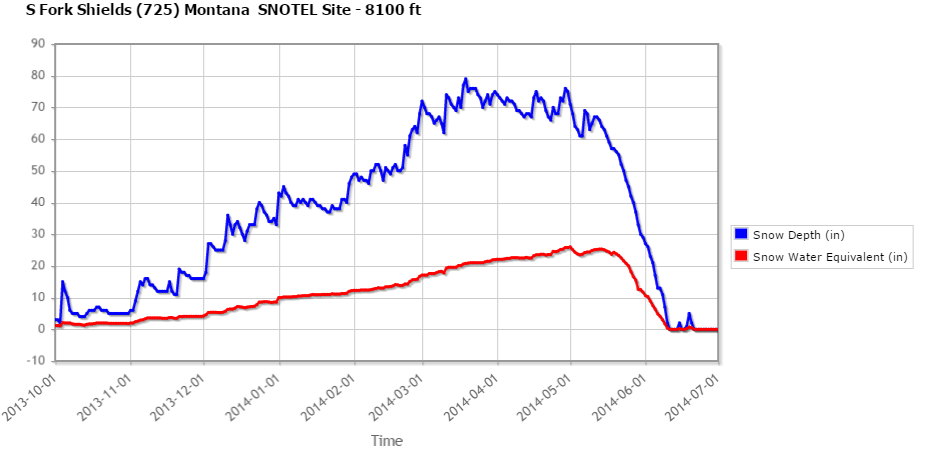
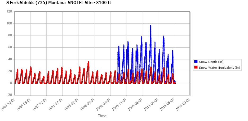
SOUTH FORK SHIELDS SNOTEL STATION HISTORICAL DATA
Winter 2015-16
Winter 2014-15
Winter 2013-14
All the available snow data from S Fork Shields SNOTEL Station from every winter since 1980:
Click to view additional data from S Fork Shields SNOTEL Station
Winter Wildlands Alliance is a national nonprofit organization promoting and
preserving winter wildlands and a quality human-powered snowsports
experience on public lands.

![]()